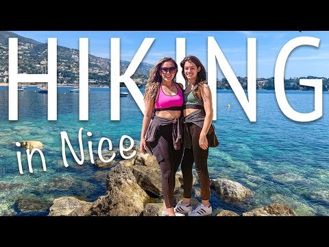
Local hiking tours in France

France is famous for its rich culture, history, and stunning scenery. While many tourists flock to the country's main cities and attractions, there is a breathtaking natural landscape to discover too. Local hiking tours offer an excellent way to explore the country's diverse regions, from the stunning coastline of Brittany to the rugged mountains of the Pyrenees. Whether you're an experienced hiker or a beginner, there is a trail to suit every level. In this article, we'll take a closer look at some of the best local hiking tours in France and what makes them so special. So, grab your boots, pack your backpack, and let's hit the trails!
What is the best hiking map for France
France is undoubtedly one of the most scenic countries in the world, with a diverse range of landscapes and terrains that are perfect for hiking enthusiasts. From the rugged coastline of Brittany to the rolling hills of Provence, there is something for everyone. However, to make the most of your hiking trip in France, you need the right map. Here are some of the best options available:
 Experience local music and performances in France
IGN Maps
IGN (Institut Géographique National) is the national mapping agency of France and produces some of the most detailed and accurate maps in the country. Their maps are perfect for hikers as they show detailed topography, trails, and contours, as well as points of interest such as campsites, viewpoints, and water sources. IGN maps are available in different scales and cover all regions of France. They are also waterproof and tear-resistant, making them ideal for outdoor use.
TOP 25 Maps
TOP 25 maps are another popular option for hikers in France. Produced by the French hiking federation (FFRandonnée), these maps cover the most popular hiking areas in the country. They show detailed topography, trails, and landmarks, and are available in different scales. They are also laminated, making them durable and weather-resistant.
Michelin Maps
Michelin is a well-known brand in France, famous for its restaurant guides and road maps. However, they also produce hiking maps that are worth considering. Michelin maps show trails, topography, and points of interest, and are available in different scales. They are also laminated and tear-resistant, making them durable for outdoor use.
OpenStreetMap
For those who prefer digital maps, OpenStreetMap is a great option. It is an open-source platform that allows users to contribute and edit maps, resulting in a highly detailed and up-to-date map of France. The platform offers a range of features such as contour lines, hiking trails, and points of interest. It can be used offline through apps such as MAPS.ME, making it a convenient option for hikers.
 French beach tours
Conclusion
Choosing the right hiking map for France depends on your personal preferences and needs. IGN maps are perfect for those who want detailed topography and accurate trail information, while TOP 25 maps are great for those who want laminated and weather-resistant maps. Michelin maps are a good option for those who want a well-known brand, and OpenStreetMap is perfect for those who prefer digital maps. Whatever your choice may be, make sure to choose a map that is suitable for your hiking trip and helps you make the most of your experience in France.
Does AllTrails work in France
AllTrails is a popular app that helps hikers and outdoor enthusiasts find trails, plan routes, and navigate with ease. If you're planning a hiking trip to France, you might be wondering: does AllTrails work in France?
The answer is yes! AllTrails has a large database of trails in France, including popular destinations like the French Alps, Mont Blanc, and the Pyrenees. You can use the app to search for trails based on location, difficulty level, and length. You can also filter your search by features like dog-friendly trails, kid-friendly trails, and wheelchair accessibility.
 Explore local parks and gardens in France
With AllTrails, you can view trail maps and download them for offline use, so you don't need an internet connection to navigate your route. You can also track your progress and see your stats, including distance, elevation, and speed. And if you're hiking with friends, you can share your route and location with them in real-time.
One thing to keep in mind is that some trails in France may have different names or markings than what you're used to, so it's always a good idea to double-check your route with a local expert or guide. Additionally, some trails may have restrictions or closures due to weather, wildlife, or other factors, so be sure to check for updates before heading out.
If you're planning a hiking trip to France, AllTrails is a great tool to help you explore the country's stunning natural landscapes. Whether you're a seasoned hiker or a beginner, AllTrails can help you find the perfect trail for your skill level and interests. So pack your bags, lace up your hiking boots, and get ready to discover the beauty of France with AllTrails.
Whether you're a seasoned hiker or just starting out, France offers some of the most breathtaking landscapes in the world. From the Alps to the Pyrenees and everything in between, there's no shortage of local hiking tours to explore.
 Local wine and cheese tours in France
So, lace up your boots, grab your gear, and get ready to discover the beauty of France on foot!
Thank you for reading our guide to local hiking tours in France. We hope it has inspired you to get out and explore this beautiful country. Bon voyage!
Goodbye and happy hiking!
If you want to discover other articles similar to Local hiking tours in France you can visit the category France.
Leave a Reply

¡More Global Tours!